
|
Red Top Fire LookoutA California Department of Forestry and Fire Protection Fire LookoutMadera, Mariposa, Merced Ranger Unit |
![]()
![]()
|
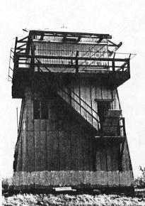
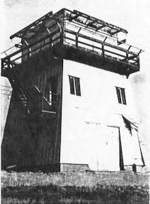
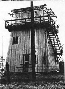
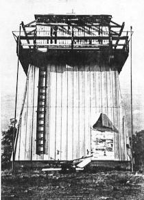
Red Top Fire Lookout was constructed in or about 1938 on one acre of land. It is located at an elevation of 1,840 feet and is on Madera County Parcel located in the Southwest 1/4 of Section 22, Township 9 South, Range 20 East, Coarsegold, California. The lookout is West of State Highway 41 and North of County Road 406. It is located on private property and there is no public access to the site any longer. Very little is known about the Red Top Lookout, it's principal use was for wildland fire detection. During the Second World War it possibly was also used as an aircraft observation post, as were many of the lookouts located in this area which were used for that. There seems to be no historical value to the lookout, unless it would be in the unusual shape of the structure shown below, in the September, 1990 B/W photos. The lookout is of wood frame construction and covered with aluminum siding. It sits on a concrete foundation and is shaped somewhat like a pyramid. The cap or lookout part is square and has a pyramidal roof with tin covering. Wooden shutters shade the windows on all four sides of the lookout section. The living quarters are in the lower stories of the three story structure. The lookout ended its use in 1985 and the tower was turned over to the property owner. It is still standing as of 2008. The lookout has now been torn down by the property owner in 2010. The above information was provided courtesy of Ahwahnee CDF, Ahwahnee, CA. |
![]()
| These are private web pages and are not maintained by any governmental agency, all representations are for educational and informational purposes only! See Disclaimer and Legal Stuff for more details. |
1995 Miami Mountain Volunteer Fire Lookouts
fire-lookouts.org
All Rights Reserved